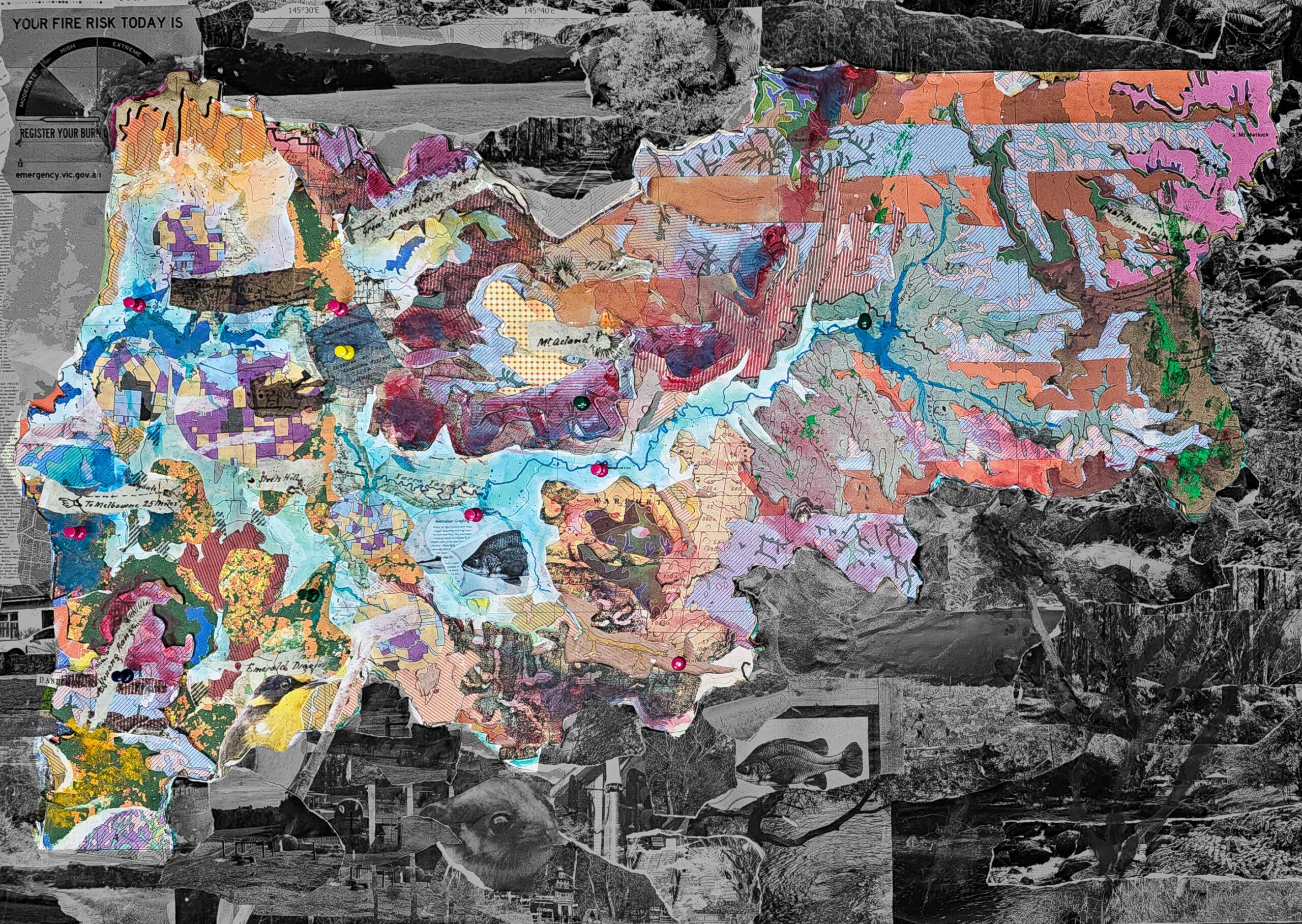
Geospatial Modelling
Yarra Ranges Shire is a vast and diverse region east of Melbourne, ranging from forested mountains and lush valleys to rural townships. It contains significant natural and cultural landscapes. Working as a group, the site was understood through GIS and mixed-media methods, known as Geoart. This approach helps translate the scale and complexity of the region into tangible knowledge.
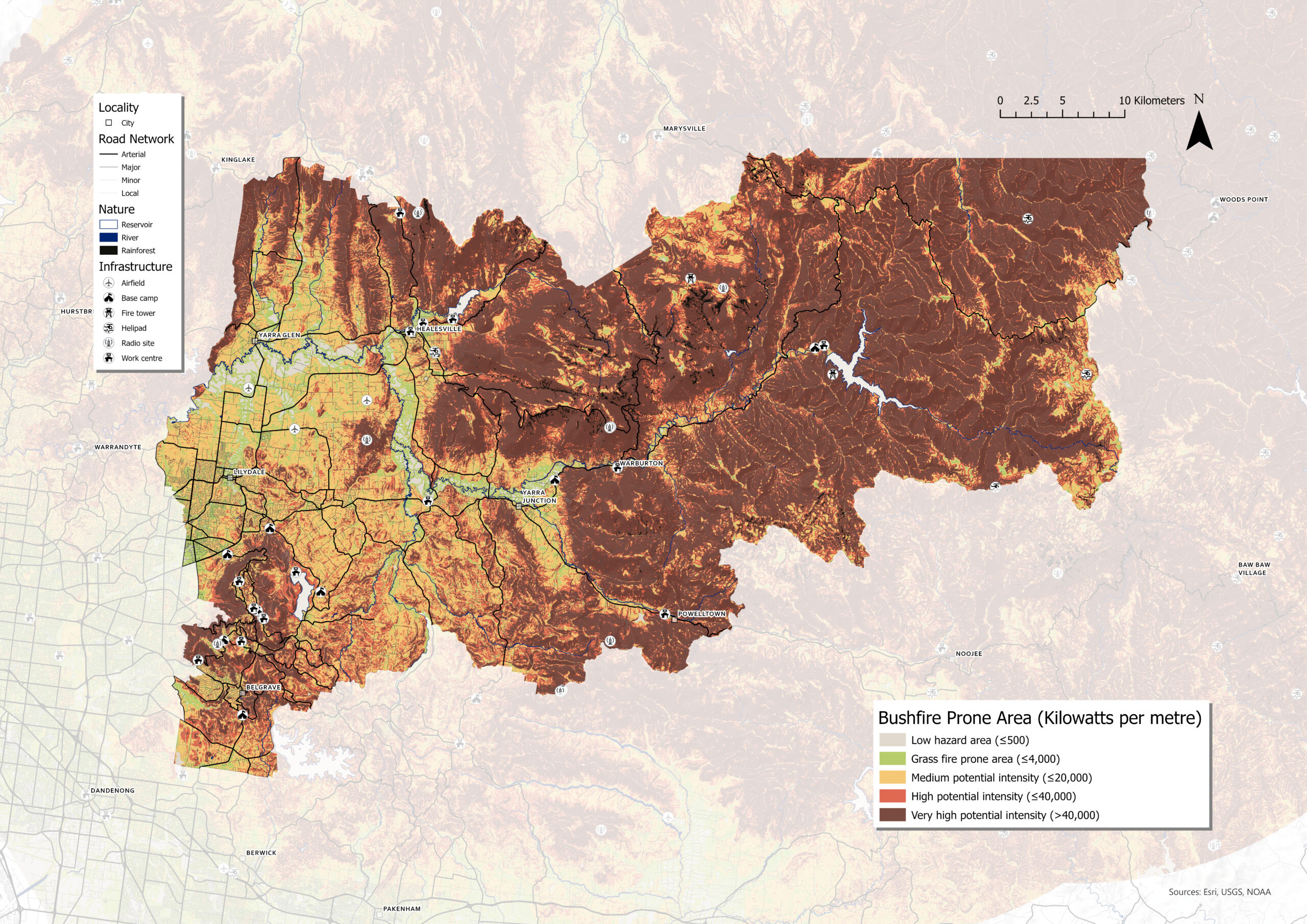
Yarra Ranges Shire is important to the Victorian economy, and bushfire poses a major risk. Using the skills developed during the site analysis, the landscape was examined through the lens of fire. Guided by CSIRO research and Byram’s formula, the Shire is studied through three factors: fuel load in relation to vegetation, fire spread in relation to the landscape, and combustion heat in relation to weather conditions.
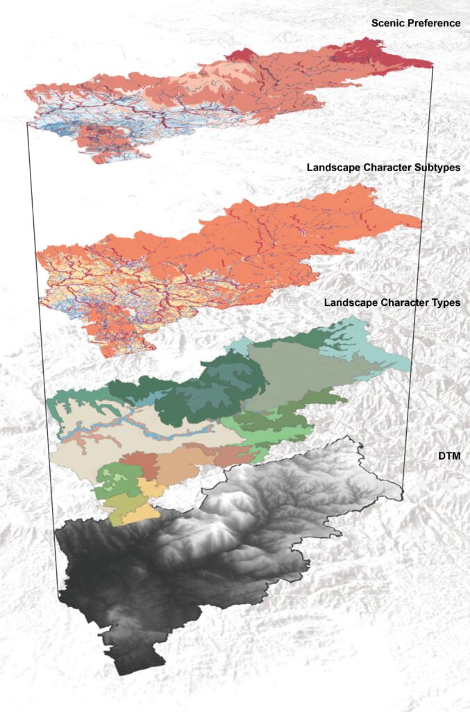
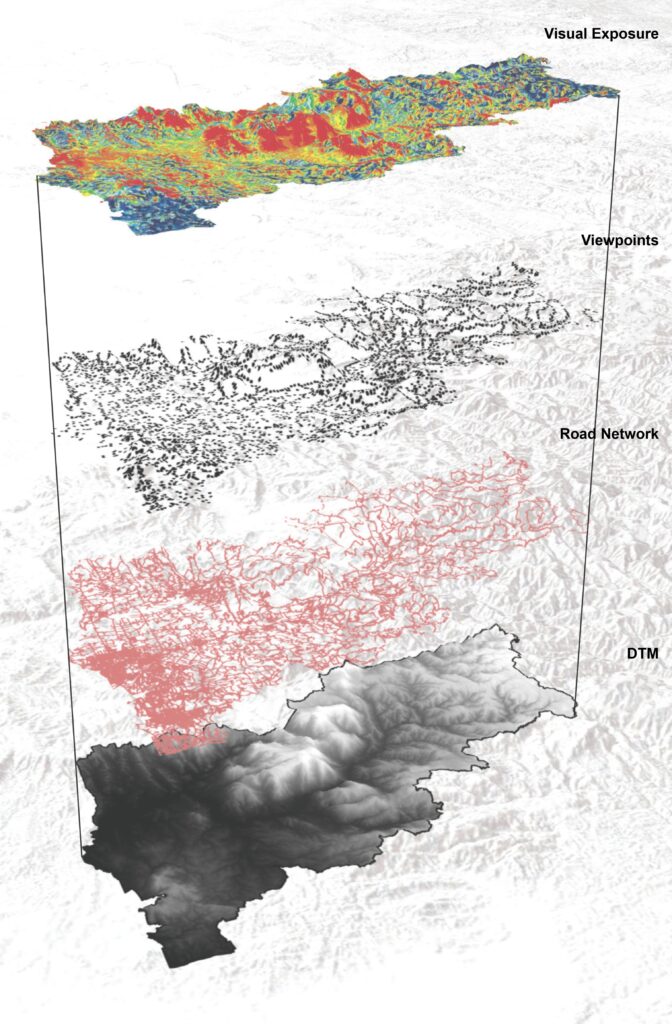
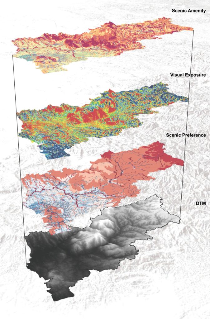
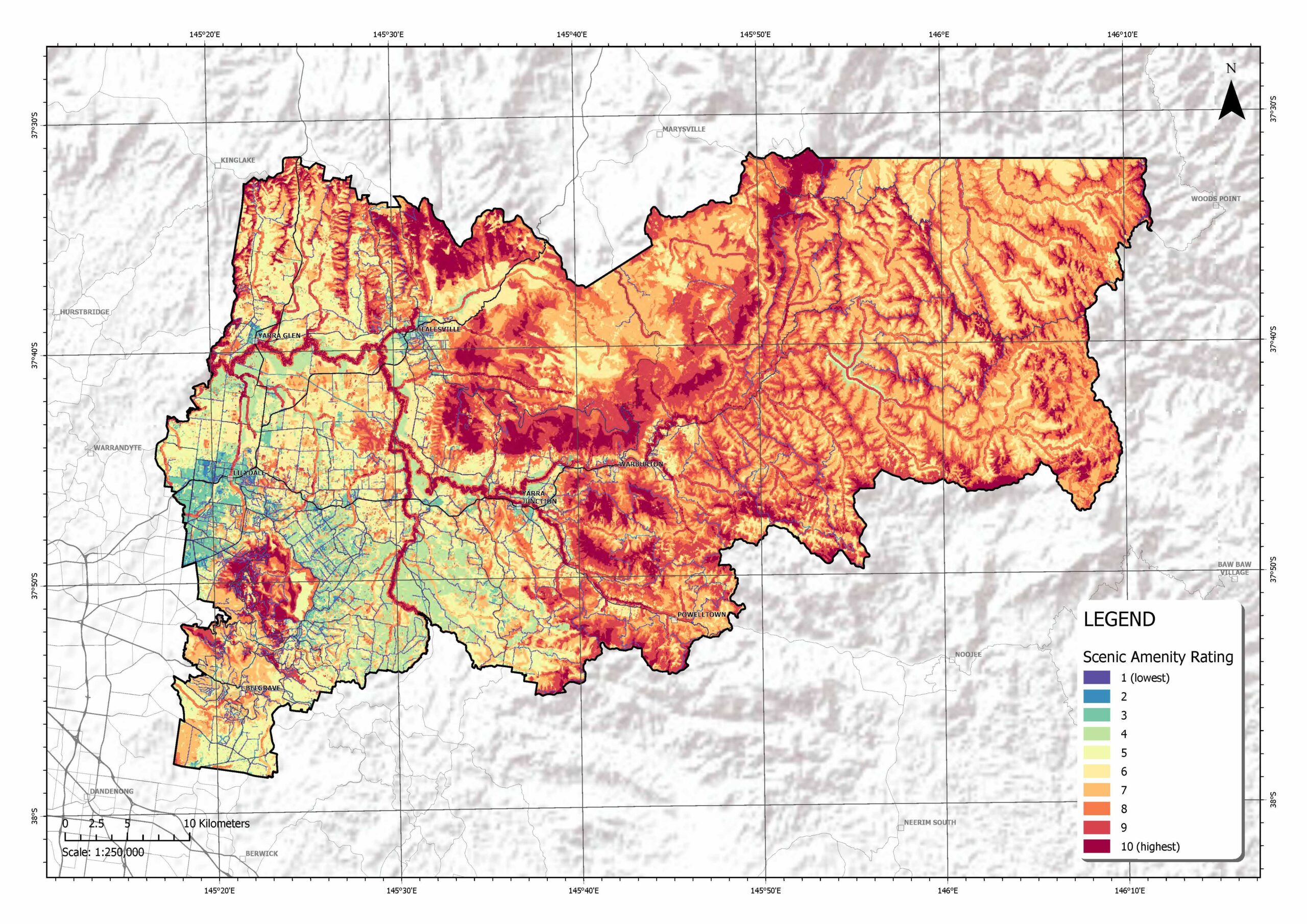
Scenic Views


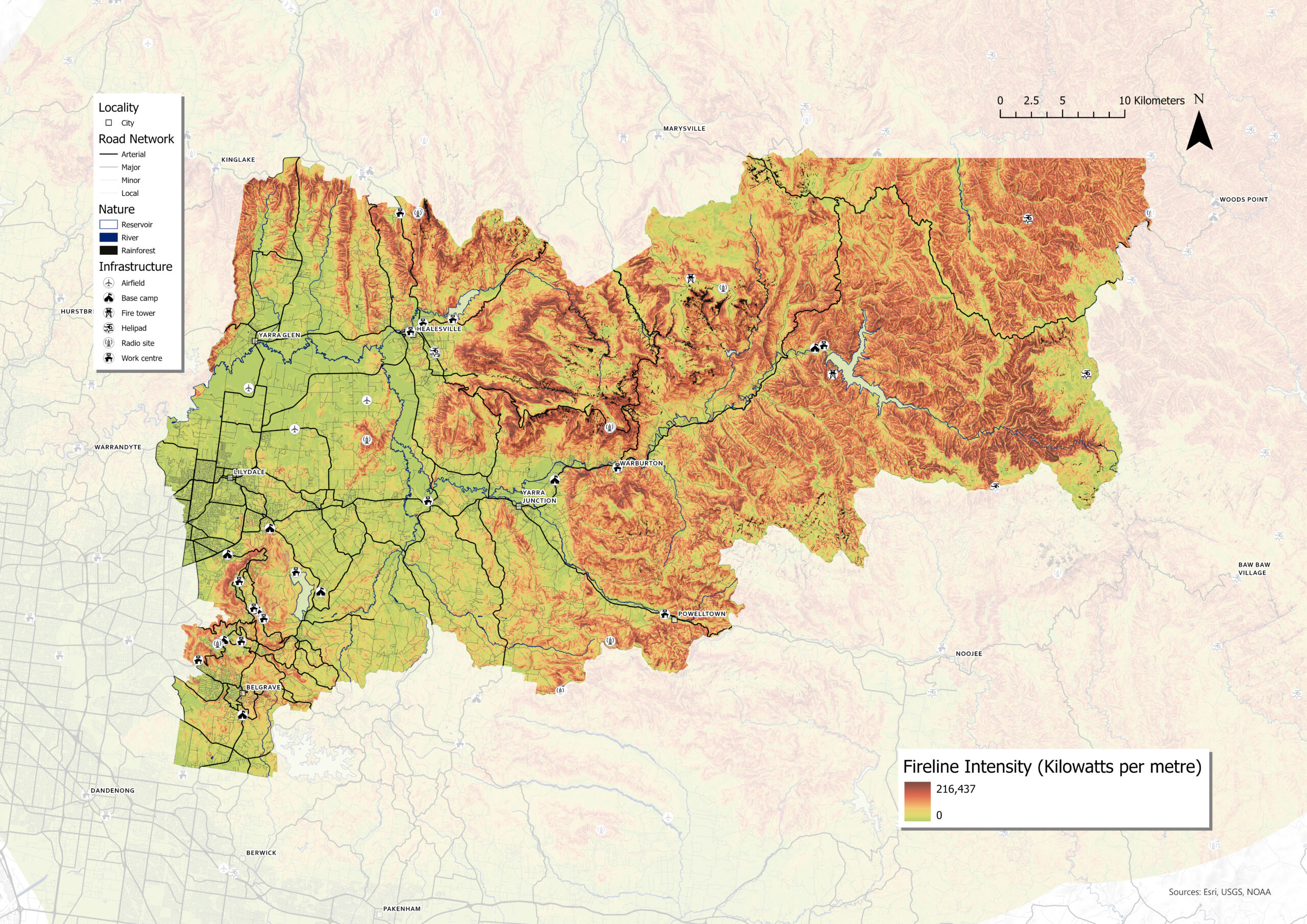
Defining the Fire Intensity
Fire intensity is defined by the fireline. A fireline is a designated area intended to halt the progression of a wildfire based on the surrounding combustible elements. The intensity of the fireline can be used to quantify the danger and rate of wildfire spread. For the Yarra Ranges Shire, protecting the region’s economic assets from fire is paramount because it is heavily dependent on the natural environment.
Fuel load (FL) is defined by the vegetation hazard class (tonnes/ha) because denser vegetation increases the amount of combustible material. Fire spread (FS) is defined by landscape slope (degrees) because steeper slopes accelerate the rate of fire movement. Combustion heat (CH) is defined by the Forest Fire Danger Index (FFDI) because weather conditions influence the behaviour and trajectory of a fire.
Fireline intensity (FI) is determined by these three elements.
FI = FL x FS x CH
Fireline intensity is measured as the amount of energy released per unit length (kilowatts per metre). Mapping fireline intensity enables strategic placement of firebreaks and firefighting resources across this vast and important region.


Wurundjeri Woi Wurrung & Taungurung Country
Yarra Ranges, Victoria, Australia
Landscape Studio 4 | 2024 Semester 2 | Ata Tara
Site Area: 2,468 km²
Elevation: 10–1,398 m AHD
Height Change: +1,462 m
Analysis of scenic amenity is developed as group with Josh Yu and Amber Liang for Yarra Ranges Shire. Fireline intensity is conducted individually.